1. Fuel Debt
NDVI departure from rolling baseline for cumulative drying trajectory.
Pre-Ignition Intelligence for Emergency Management
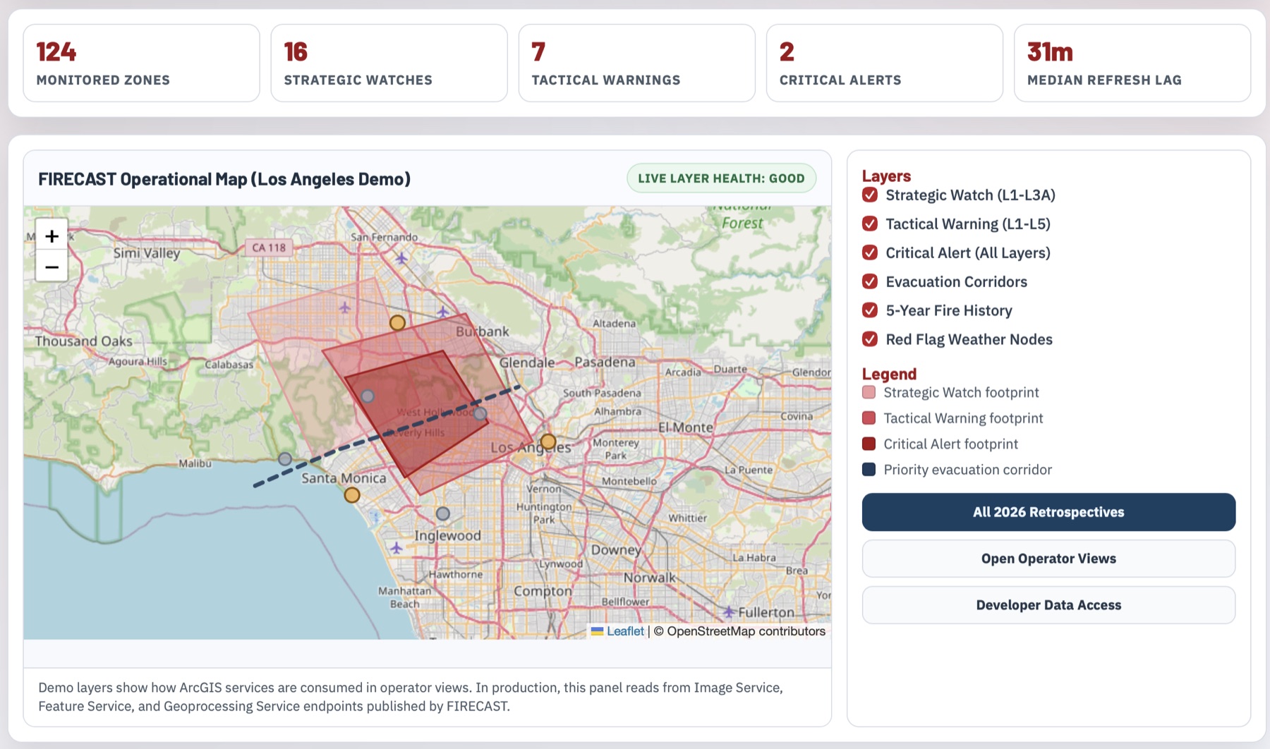
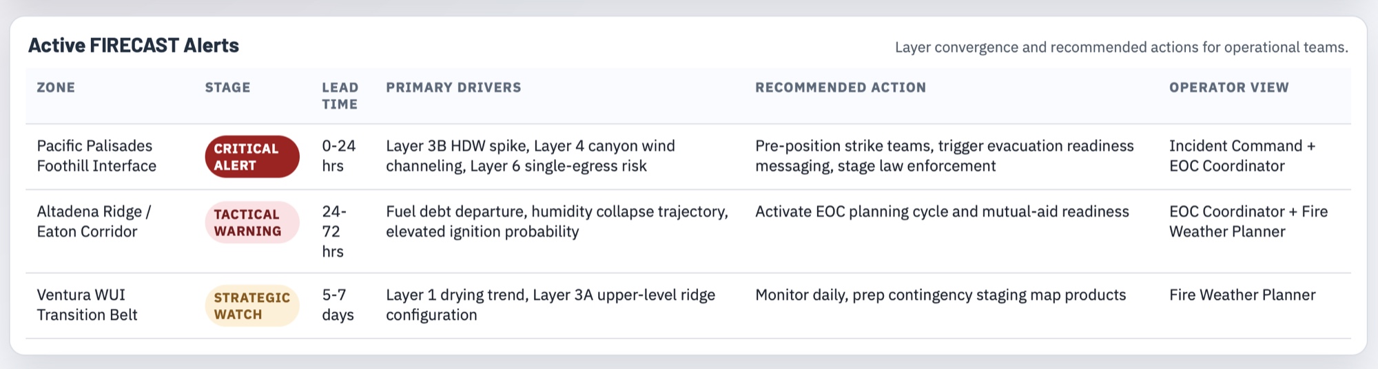
ArcGIS-native decision support for compound wildfire risk. Embera integrates atmospheric triggers, fuel stress, ignition probability, and community vulnerability into one operational picture with role-based views for Incident Command, EOC, planners, and staging teams.
Existing systems typically activate after ignition. Embera is designed to move warning posture from roughly 60-90 minutes after ignition to 3-5 days of pre-ignition intelligence where resources, messaging, and evacuation readiness can be staged before impact.
One backend stack, published as ArcGIS Image/Feature/GP services.
NDVI departure from rolling baseline for cumulative drying trajectory.
LFMC trajectories calibrated with station observations.
Strategic 5-7 day atmospheric detection plus 0-72 hour operational trigger.
Terrain-amplified downscaling for canyon and foothill exposure.
ML ignition likelihood using utility corridors, slope, history, and vegetation.
Population exposure, evacuation feasibility, burn envelopes, and triage outputs.
Reference views from current operations and prototype mapping interfaces.
From retrospective validation to live pilot operations.
| Phase | Timeline | Deliverable |
|---|---|---|
| 0 | Weeks 1-4 | LA Basin Fuel Debt retrospective published as live Image Service. |
| 1 | Weeks 5-10 | Layers 1-3+5 retrospective replay for January 2025 events. |
| 2 | Months 3-6 | Multi-event validation, Layer 6 vulnerability, Layer 7 Monte Carlo. |
| 3 | Months 6-10 | Automated real-time pipeline and four ArcGIS operator views. |
| 4 | Months 10-15 | Pilot deployment with county OES/CAL FIRE unit for one season. |